Google Maps is indeed the best navigation app ever made for Android. While the navigation app is also available for iOS users, it’s mainly used by Android users. The Google Maps app now comes built-in on most new Android smartphones.
Google Maps is a navigation app that can help you in multiple ways. It can help you find cheaper gas, navigate the road, avoid tolls, get you the live train running status, and more. Now it looks like Google Maps app got another great feature that shows the air quality around you.
Google Maps app for Android & iOS now has a new map layer that shows the air quality index (AQI) data around your location. The feature had been under testing since last year, and it was finally made available to the public.
Steps to Check the Air Quality Index (AQI) in Google Maps
Now that the Air Quality layer has been added to the Google Maps app, you may want to use it to your advantage. Below, we have shared a step-by-step guide on checking the air quality around you via Google Maps for Android. Let’s get started.
1. Open the Google Play Store on your Android and update the Google Maps app.
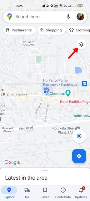
2. Once updated, open the Google Maps app on your Android device.
3. Next, tap on the layer icon in the Google Maps located in the top-right corner.
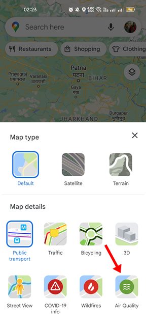
4. You will now see the Map type and details panel. On the Map details, tap on the Air Quality option.
5. This will enable the air quality view on your Google Maps app. Now Google Maps will automatically zoom out and show an overview of your location’s air quality.
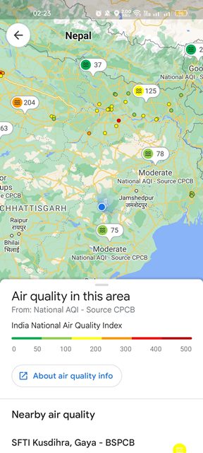
6. Google Maps will also show you the nearby air quality monitoring stations. The stations would appear on the map as tiny bubbles.
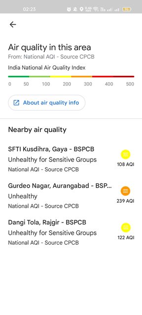
That’s it! This is how you can check the Air Quality around you via Google Maps. Google Maps access the air quality data from the government offering stations, and it utilizes the NowCast algorithm to calculate the data from the raw sensors and convert it.
Besides the air quality index, Google Maps recently introduced a few other features such as measuring distances, live train running status, and more.
So, this guide is about checking the air quality around you via Google Maps for Android. If you already use this new feature, let us know how accurate it is. If you need any more help, let us know in the comments.


